All standard hiking footnotes apply, ie, take water, know your ability, don't overdo it, etc. I'm not in great shape, so I took my time. Going up was about 90 minutes, coming back down about 60 minutes. The trail starts out on a wide abandoned road. And then the switchbacks start going up. And up and up and up.
Even if you don't do the hike, I think the scenic views makes the drive worth it.
USDA Website, more info:
https://www.fs.usda.gov/recarea/htnf/recreation/hiking/recarea/?recid=65574&actid=50
Directions:

Drive in:


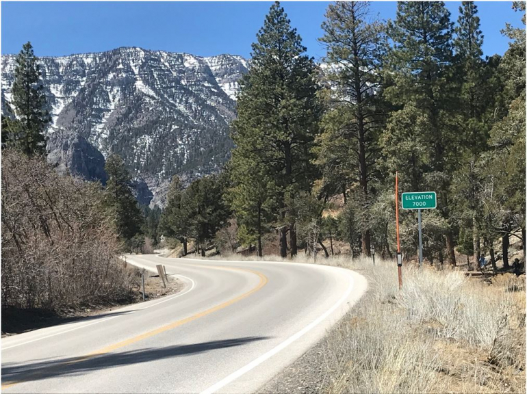
The altitude where I live is about 1000 feet. The altitude in Vegas is about 2000 feet. The altitude at the trail is much higher than either of those !

Follow these signs to get to the closest parking area:


Views from the Trail:


When you get to the Rock Wall, you are getting closer:

Made it ! Some, but not a lot, of water in the falls today.


Quote: WizardThanks for the report! That hike will be crowded on a summer weekend. I'd suggest looking into Big Falls next time. To get there, you turn left when you get to the switchbacks, as opposed to right. Then follow the drainage. There is not a maintained trail and it involves a little scrambling. At the end is a bigger waterfall most of the time. An exception is late in summer it goes dry.
Are the rocks hot to the touch in the summer?
I ask because my first visit to the Valley of Fire was in January and you can scramble over the rocks. My next visit was in the summertime and two minutes into the same hike, I put my hand on a rock and blistered it so badly it affected my ability to play BJ for the week. Lesson learned.
On this particular trail, there wasn't any rock scrambling required. A lot of the trail is partially shaded. But I would bring sunscreen for the parts that aren't !
Quote: billryanAre the rocks hot to the touch in the summer?
Not at Mount Charleston, which is higher up than Vegas and about 10 degrees cooler.
Lower down, if it were hot enough for rocks to get so hot they were painful to touch, I wouldn't be out exercising anyway.
Quote: billryanAre the rocks hot to the touch in the summer?
Not at Mount Charleston, which is higher up than Vegas and about 10 degrees cooler.
Lower down, if it were hot enough for rocks to get so hot they were painful to touch, I wouldn't be out exercising anyway.
Thanks, duly noted, and "challenge accepted" for my next trip. How much elevation change should I expect ? More or less than Mary Jane Falls ?Quote: WizardI'd suggest looking into Big Falls next time.
Quote: JohnnyQThanks, duly noted, and "challenge accepted" for my next trip. How much elevation change should I expect ? More or less than Mary Jane Falls ?
Less. It's probably longer than Mary Jane though. I recommend Big Falls not because it's a bigger challenge but it's more fun and less crowded.
Is anyone aware what the trail conditions to Charleston Peak can be expected to be like last couple days of April or first week of May? Bring along some microspikes for higher elevation and should be ok?
Anyone been out to Ash Wildlife Preserve to see the prehistoric pup fish that only exist there? Worth it if by Death Valley already?
Planning to possibly summit Telescope Peak in Death Valley where you can see both highest and lowest points in lower 48 from, Charleston Peak, and Humphreys Peak by Flagstaff within a weekish span so that I only have to acclimatize once. Sounds like Humphrey will probably be sort of a mess some stage of muddy/melt off.
I assume Mt. Charleston is at least as windy, and colder.
MD: Are you back in VEGAS already ? ? ? Looking forward to your next trip report from Casino Royale ( haha just kidding ). But, fyi, I think they still have a $ 20 Loss rebate. I hope that isn't too much AP info to "let out of the bag", should I have PM'd you on that ? ? ?Quote: MDawgIs it too windy to hike Red Rock Canyon today?
ANYHOWS:
I assume Mt. Charleston is at least as windy, and definitely cooler. I can vouch for cooler based on the elevation - which made a hike in July at Mt Charleston quite pleasant. But this picture is from early April of this year:


