
Historic Railroad Trail
by Michael Shackleford • Nov. 27, 2013
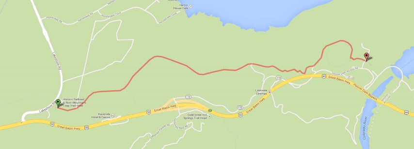
Click on any image for a larger version. Image from GoogleMaps.com.
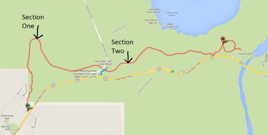
This trail is a lot of fun and one of the best free outdoor activities in the Las Vegas area. The second section of the trail makes use of an old railroad tunnel, used at one time to bring supplies to construct Hoover Dam. Some time after it was completed, they removed the old tracks and made a hiking/biking trail out of it. The second part of the trail is a well-graded dirt path. It is nice and wide so bicyclists and walkers won't interfere with each other. The trail offers great views of Lake Mead, goes through lots of tunnels, and ends up at one of America's most famous tourist attractions -- Hoover Dam.
There seems to be a lot of disagreement about where this trail starts to the west. GoogleMaps and TrailLink indicate the trail starts in Boulder City at Pacifica Way. However, the National Park Service indicates it starts further east, off Lakeshore Road, just past the Lake Mead National Recreation Area Visitor Center.
After much debating with myself, I decided to break this trail guide into two sections. Part one is a paved section between Pacifica Way and Lakeshore Road. Part two is a gravel section between Lakeshore Road and Hoover Dam. Both parts are moderately steep heading west. If you're in decent physical shape and looking for more of a challenge, I would do both parts. Alternatively, if you haven't touched a bicycle in years, are not in the best shape, or are walking the trail, I would suggest playing it safe and starting at Lakeshore Road.
As mentioned, part two is unpaved. However, it is a flat gravel path that is about as easy as off-road biking gets. Given the choice, I would recommend using a mountain bike. However, if a hybrid is all you have, that should be sufficient. Finally, part two also makes for a nice walking trail. In fact, about 90% of the groups I passed were walkers.
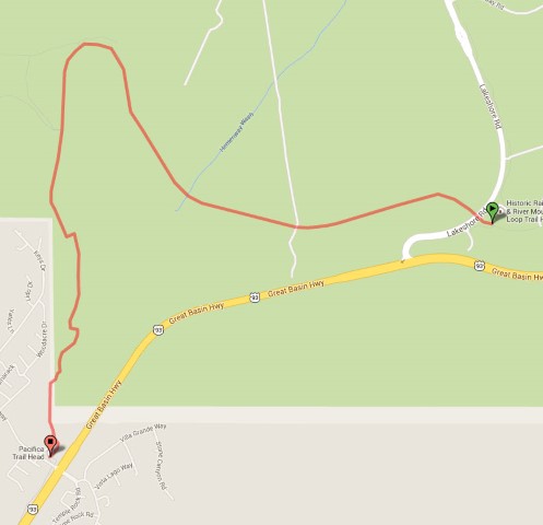
Section One — Pacifica Way to Lakeshore Road
Key Facts
- Western terminus: The Pacifica Trail Head at the intersection of Pacifica Way and Highway 93 in Boulder City.
- Eastern terminus: Historic Railroad and River Mountains Loop Trailhead, just past the Lake Mead Visitor Center.
- Distance: 3.6 miles.
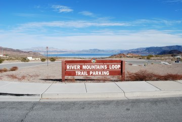
To reach the Pacifica trailhead from Las Vegas, take the 93 Highway to Boulder City. Turn left onto Pacifica Way, which is on the east edge of Boulder City. There is a large parking lot on the right with a sign saying River Mountains Loop Trail Parking. Part one of this trail is along the River Mountains Loop trail.
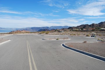
There shouldn't be any trouble parking. The number of cars when we arrived the day before Thanksgiving, which is normally a busy day for Las Vegas, was zero. The trail starts by the kiosk on the right.
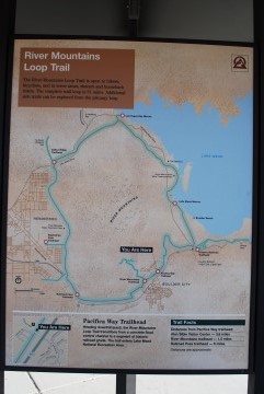
This sign shows the both the River Mountains Loop and Historic Railroad trails. Part one goes from the "You are here" dot to the circle to the east marked "Historic Railroad Trailhead." Part two is the blue dotted line from there.
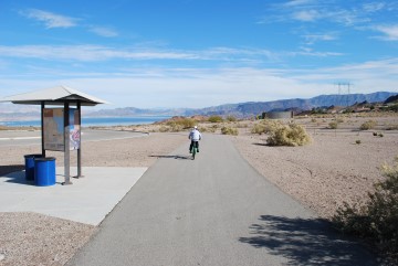
Pick up the trail by the kiosk, where the map is.
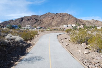
The trail makes a turn and heads north. There are some very upscale homes on the left with nice lake views. One of them has an artifical waterfall coming down from the mountain that backs against the house.
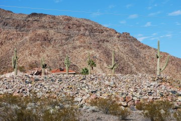
This house had a nice collection of saguaro cacti.
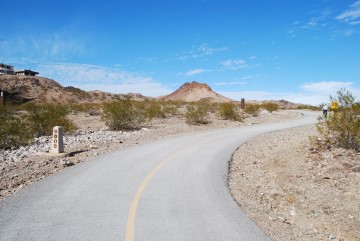
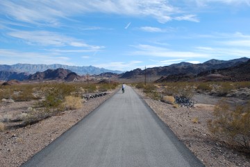
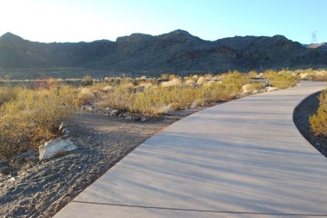
The trail makes several turns as it meanders through the desert.
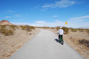
They were kind enough to drop the speed limit around the sharp turns to 10 MPH.
This section is also part of the River Mountains Loop trail. You'll see these trail markers every half mile.
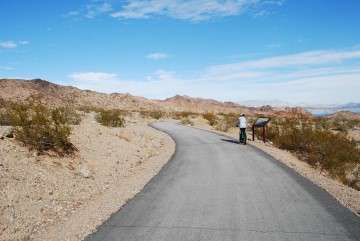
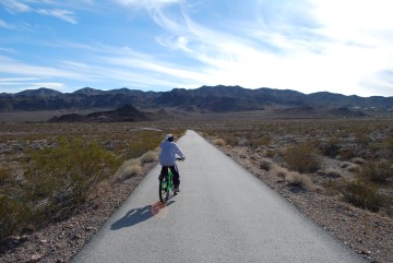
Lots of informative signs, like this one on the right my son is reading.
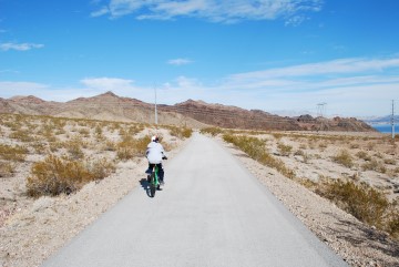
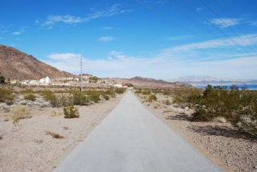
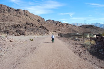
This section is fun heading east because it is downhill. You can coast almost the whole way.
These wires carry electricity from the dam.
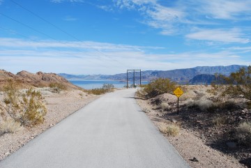
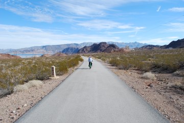
No shortage of nice lake views.
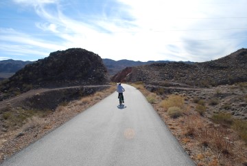
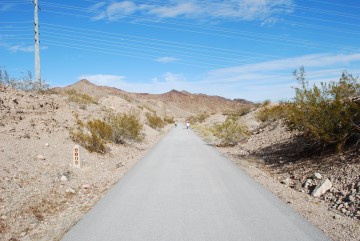
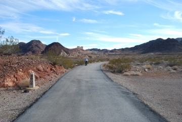
Here the trail cuts through this little hill.
The trail heads south again.
Heading east.
This is what passes for a cloudy day in Las Vegas.
You can barely see the Hacienda hotel/casino off in the distance.
This tunnel goes under Lakeshore Drive as you come to the end of part one.
The gravel path straight ahead is where part two begins. Alternatively, you can turn left to get to the parking lot for part two, or right to get to the Lake Mead National Recreation Area Alan Bible Visitor Center.
Section Two — Lakeshore Road to Hoover Dam
Key Facts
- Western terminus: Historic Railroad and River Mountains Loop Trailhead, just past the Lake Mead Visitor Center.
- Eastern terminus: Hoover Dam parking garage.
- Distance: 3.5 miles.
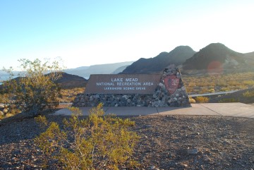
If you're doing section two only, exit Highway 93 at Lakeshore Road. First you'll go by the Lake Mead National Recreation Area Alan Bible Visitor Center. Do not be tempted to park there. Keep going a little further to the parking lot for the trailhead.
You may see signage about entering a fee area. Don't worry, you won't be asked to pay anything unless you go past the trailhead on Lakeshore Road.
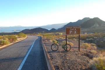
The parking lot is to the right, just past this sign.
This is where you are.
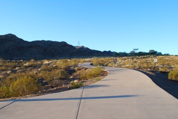
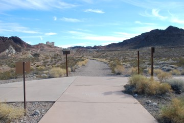
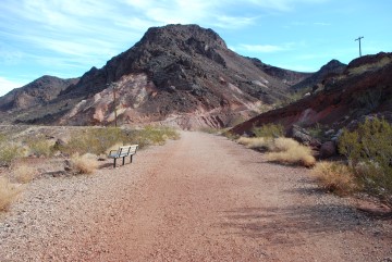
Look for this path heading south, near some kiosks at the edge of the parking lot.
There are two dirt paths heading off the paved trail. Both will take you to the dam. This is the first one. The second is just ahead, seen in the last picture in section one. They merge together about 200 feet down the trail.
Go through this gate.
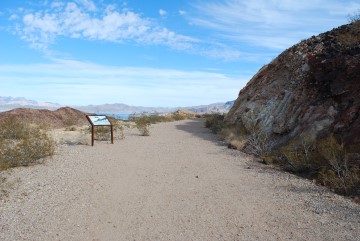
Plenty of informative signs to read, like this one to the left.
If you get tired, there are benches to sit and enjoy the lake view.
To the right is a side trail leading to the Hacienda hotel/casino.
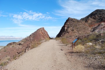
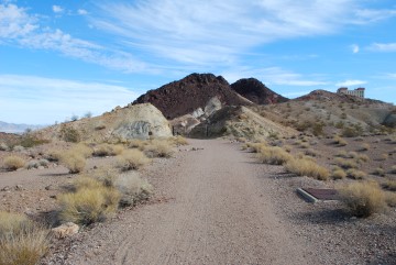
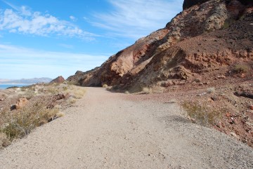
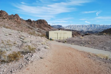
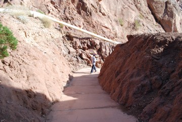
The trail cuts through this hill.
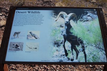
One of many educational signs.
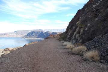
Lake Mead to the left. Note the white bathtub ring, reflecting the low water level.
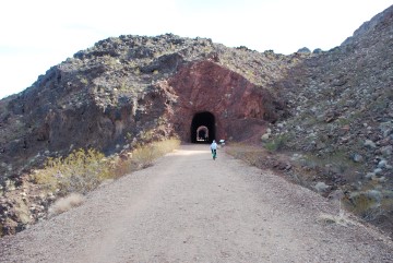
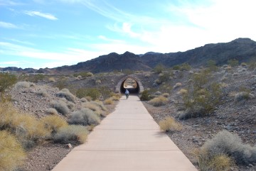
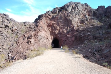
The first tunnel. You can see the second one through it.
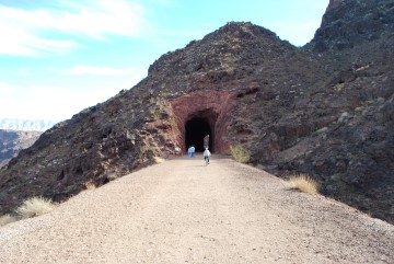
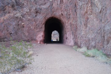
Here is the second tunnel.
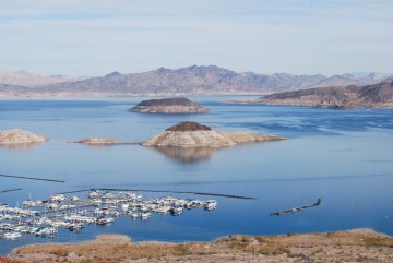
That is the marina on the left. Note that island straight ahead. In 1985 only the brown part was above water. Lake Mead is the main water source for Las Vegas, and the lake level keeps dropping.
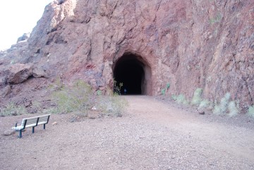
Tunnel number three.
Tunnel number four.
Tunnel number five.
There is a public bathroom here. The trail resumes to the left, just before that covered picnic table.
Trail resumes through this gate.
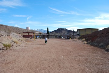
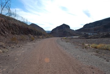
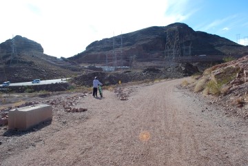
The trail is briefly on this paved section ahead. Go in the direction towards the yellow shed.
There is a shortcut to the right. However, I recommend sticking to the main path, which is more scenic.
You'll pass some old mining equipment on the right.
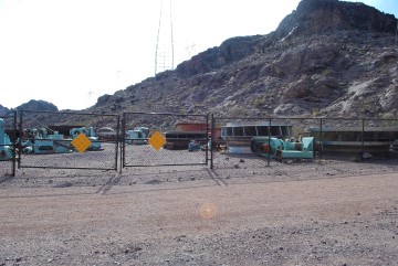
Here is a direct view of the mining equipment. I assume those big round things are old turbines from the dam.
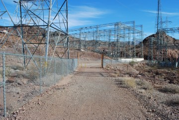
You can start to see lots of electrical stuff here.
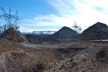
To the right you this electrical grid, if that is the correct term. You can also hear the electricity crackling through the many wires.
Take the path to the left. The right path is the end of the shortcut.
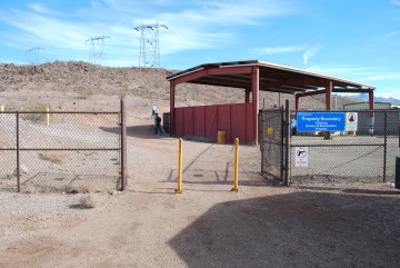
Lots of gates to go through.
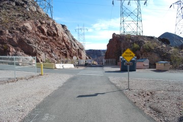
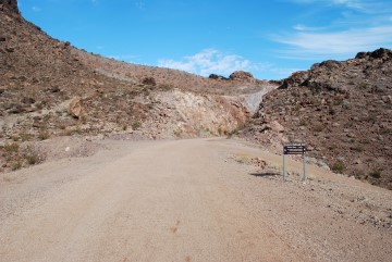
Coming close to the end. Turn right here to visit the Hoover Dam Bypass Bridge. The parking lot for that is about a quarter mile down that crossroad.
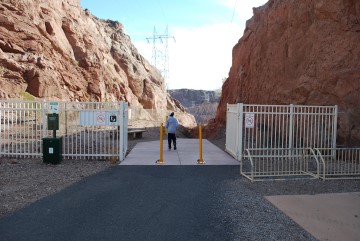
Bikes are not supposed to go past this gate. You can see there is a bike rack for them.
If you wish to continue to the dam, follow this path leading to the Hoover Dam parking garage.
Here is the top level of the parking garage. You can see the bridge on the right.
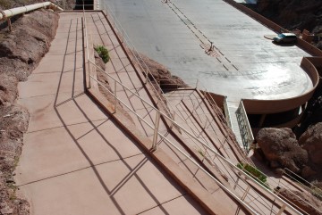
Walk down these switchbacks.
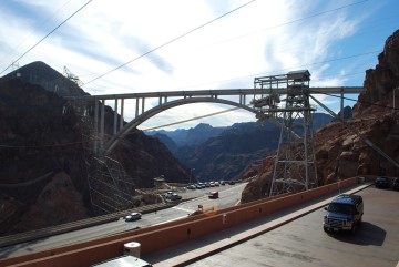
Nice view of the bridge from the parking garage.
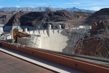
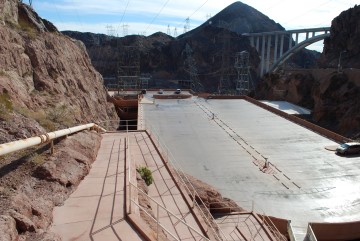
View of the dam from the parking garage.
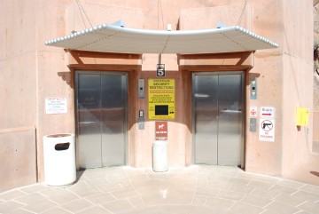
You can go down to the dam level on this elevator.
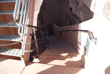
However, for full credit, take these steps.
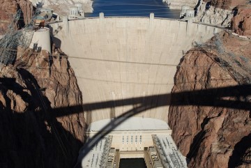
Now you're at the dam! This photo was taken from the Hoover Dam Bypass Bridge. Following are some Hoover Dam pictures I took, to just scratch the surface of what a Hoover Dam visit is like.
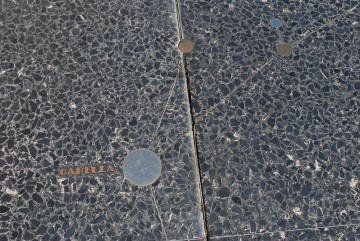
On the Nevada side, by the museum, there is a big star map. This photo shows just one small section. It indicates the positions of the stars and planets at the time the dam was completed. As the stars revolve around the galaxy, they change positions relative to each other. Should aliens find the dam millions of years from now they will be able to determine when it was built, based on the positions of the stars inlaid in this star map.
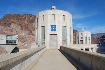
The two Nevada intake towers. This is where water enters the dam.
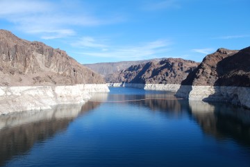
View of the Colorado River behind the dam. Note again the bathtub ring.
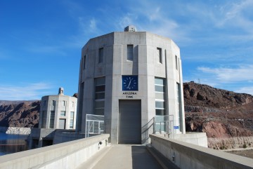
Set your watches ahead an hour. Now you're in Arizona and on standard time. Actually, Arizona doesn't observe daylight savings time, so the time is the same for about half the year.
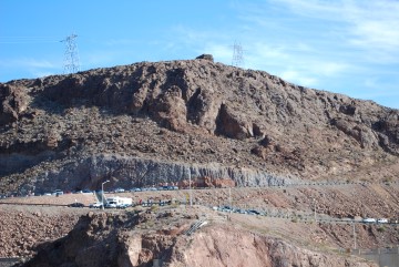
Notice that bunker on top of the hill. That was built during World War II, with lots of anti-aircraft guns, should Japan decide to attack the dam.
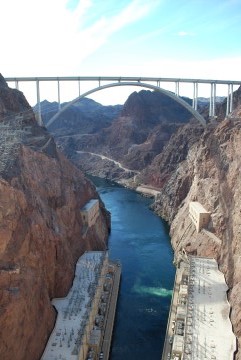
View of the Hoover Dam Bypass Bridge.
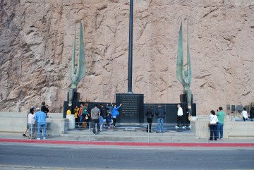
The star map I mentioned surrounds these statues.
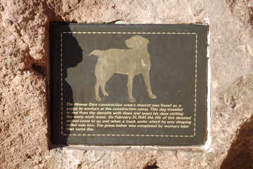
Finally, this is a plaque marking a dog that was a friend to the many workers who build the dam. After he was killed in a vehicle accident they interred him just below this sign. The sign doesn't indicate the dog's name because it became too offensive since the time the dam was built. Let's just say the dog was black and his name is used many times in Huckleberry Finn.
Interal Links
- Go to index of Las Vegas exercise trails.
- Hoover Dam Bypass Bridge
External Links
Historic Railroad Tunnel Trail — Guide from the National Park Service.
Related Articles:
-

Places to Go, Casinos to See
Jun 22, 2016 -
Casino Haiku's
Oct 30, 2015 -
Sunshine, Shadows and the Mob
Feb 24, 2017 -
Ten reasons to stay and play Downtown
Apr 15, 2015